
Tornado Warnings Disrupt Events and Damage Homes Across the Tri-State
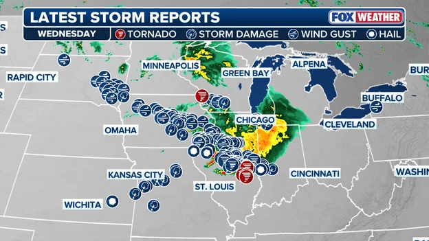
A series of severe thunderstorms rolled through the Midwest over the weekend, triggering multiple tornado warnings and leaving behind a trail of damage. In Southwest Ohio, the National Weather Service issued alerts for portions of Preble, Butler, Warren, Montgomery, Miami, and Darke counties on Saturday night as radar indicated possible tornado formation. Storm reports indicated that several homes near Eaton were damaged by strong winds just before 8 p.m., and trees were blown down in the Lebanon area and elsewhere in Warren County. A 55 mph wind gust was recorded at Middletown Regional Airport.
Further east, in Indiana, a tornado warning brought Gen Con 2026 to a sudden halt on Saturday afternoon. The convention, held at the Indiana Convention Center in downtown Indianapolis, saw some 72,000 attendees move away from windows and into interior corridors after the National Weather Service issued a tornado warning for central Marion County. The warning was issued at 5:23 p.m. ET and was effective until 6:00 p.m. ET, after Doppler radar confirmed rotation in a severe thunderstorm that was nearly stationary over the city. Before the sirens sounded, part of the ceiling in Hall B had collapsed under the weight of incoming rain, flooding the gaming floor for roughly 20 minutes.
The Tri-State area, including parts of Indiana, Kentucky, and Ohio, experienced severe weather on the same day. An apparent tornado struck Franklin County, Indiana, causing significant damage, including a barn and trees downed. The National Weather Service has indicated it will send surveyors to assess the damage and determine whether tornadoes occurred.
What the Warnings Mean and Why They Matter
The tornado warnings issued over the weekend were based on radar-indicated rotation, not confirmed touchdowns. The National Weather Service issues such warnings when Doppler radar detects a velocity signature consistent with a mesocyclone—a rotating column of air inside a severe thunderstorm that can produce a tornado. This distinction is crucial: a low probability of a tornado does not mean zero risk, and the NWS issues warnings before confirmation to give people time to seek shelter. As the Gen Con incident demonstrated, the impact of severe weather can be immediate and unpredictable, even in urban areas.
The storms also brought heavy rainfall, leading to flood warnings. The slow-moving nature of the storms meant that rainfall was concentrated over the same areas, increasing the risk of flash flooding. In Southwest Ohio, flood warnings were issued as the storms dumped heavy rains. The combination of strong winds, heavy rain, and the potential for tornadoes poses a significant threat to public safety and property. For residents in affected areas, these warnings are a reminder to stay alert and have a plan in place for severe weather.
Broader Implications and Trends
The weekend's severe weather is part of a larger pattern of intense spring and summer storms affecting the central United States. As the climate changes, the frequency and intensity of such events may increase, making advanced warning systems and public preparedness even more critical. The disruption of major events like Gen Con highlights the societal impact of severe weather, beyond property damage. It disrupts businesses, travel, and everyday life, and can pose serious safety risks to large gatherings.
The National Weather Service's use of radar-indicated rotation for warnings is a proven strategy to save lives, but it also leads to warnings that sometimes don't result in a tornado. This trade-off is necessary, but it requires public understanding. As seen in the Gen Con scenario, even a warning without a confirmed tornado can cause significant disruption. However, the alternative—waiting for confirmation—could prove deadly. For communities in tornado-prone regions, these events serve as a reminder to heed warnings, and for emergency managers, they underscore the importance of robust response plans. As the NWS surveyors head out to assess the damage in Indiana and Ohio, residents are left to pick up the pieces, while meteorologists continue to monitor for further severe weather. The resilience of communities in the face of such storms is a testament to the value of preparedness and timely communication.
For more on how severe weather and climate patterns are affecting communities, see our coverage on UK Heat Health Alerts: Fifth Heatwave Sparks New Warnings as Drought Deepens and Egypt Earthquake Today: 5.3 Magnitude Tremor Rocks Cairo and Suez.
Comments