Reno-Area Region Jolted Again as Magnitude 4.7 Earthquake Strikes Near Silver Springs
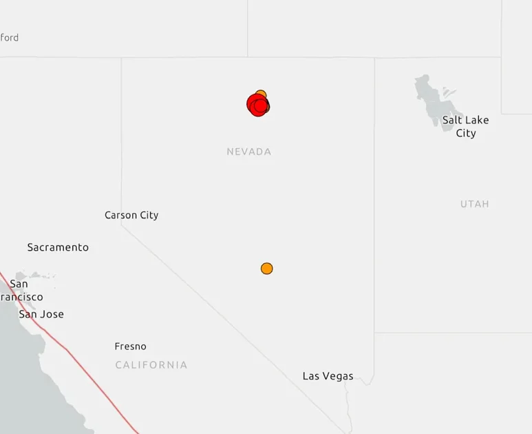
Northern Nevada residents woke up to yet another round of ground-shaking on the morning of Sunday, April 19, 2026, as a magnitude 4.7 earthquake struck near Silver Springs — roughly 11 miles southeast of that community and approximately 20 miles northeast of Yerington. The tremor, recorded at 7:39 a.m. local time, was the largest in a cluster of earthquakes that had been building since late Saturday night. A magnitude 4.2 quake had already rattled the region earlier that morning at 5:43 a.m., according to data from both the Nevada Seismological Laboratory at the University of Nevada, Reno, and the U.S. Geological Survey.
Between 11:07 p.m. on Saturday, April 18, and 10:21 a.m. on Sunday, roughly 90 separate earthquakes were recorded across northern Nevada, ranging in magnitude from 0.9 to 4.5, according to the Nevada Seismological Laboratory. The activity was concentrated in the same general area southeast of Fernley that had already produced significant seismic events in the preceding days.
No Major Damage Reported — But Concerns Persist
As of Sunday morning, Lyon County officials and emergency personnel confirmed they were actively inspecting critical infrastructure throughout the affected area. Their findings, shared in a public social media update around 11 a.m., indicated no significant reports of damage or injuries from the latest round of earthquakes. North Lyon Fire District echoed that message, urging residents to remain vigilant while affirming that firefighters were ready to respond.
Despite the reassuring early damage assessments, the persistence of the swarm left residents of Fernley, Silver Springs, and surrounding communities in a prolonged state of alert — uncertain about what the ground beneath them might do next.
A Region Already on Edge: The Week's Seismic Timeline
The Sunday activity did not emerge out of nowhere. It was the latest chapter in a seismic sequence that had been unfolding across Lyon County and the broader Reno-area region since at least April 13, 2026, when a significantly more powerful earthquake struck northern Nevada.
The April 13 Magnitude 5.7 Earthquake: The Triggering Event
The week's seismic story effectively began on Monday, April 13, when a magnitude 5.7 earthquake struck the region and was felt across much of northern Nevada. That event, strong enough to be widely noticed from Reno to rural Lyon County, served as the apparent catalyst for the ongoing swarm of aftershocks and secondary earthquakes that followed throughout the week.
Fernley residents had already experienced a wave of smaller earthquakes in the days immediately after April 13, with tremors emanating from the same general area southeast of town. By the time Sunday, April 19 arrived, the community was essentially experiencing a repeat scenario — rumbling from the same fault zone, producing a fresh series of felt earthquakes that echoed the prior week's unsettling pattern.
Aftershocks or a Continued Swarm?
The pattern raises a question that seismologists have been tracking closely: whether the ongoing activity represents standard aftershock decay following the April 13 mainshock, or whether it reflects a more complex seismic sequence in which multiple fault segments are being activated. Dr. Christie Rowe, Director of the Nevada Seismological Laboratory, addressed the situation publicly on April 20, joining local media to discuss Sunday's 4.7 magnitude earthquake near Fernley and what residents should do if the shaking continues.
While the details of Dr. Rowe's analysis focused on preparation and awareness, her public engagement with the topic underscored the laboratory's active monitoring of the situation — and implicitly acknowledged that the sequence was not yet over as of early this week.
Emergency Response: What Authorities Are Telling Residents
Across Lyon County and the wider northern Nevada region, emergency officials have moved quickly to communicate guidance to the public, seeking to balance transparency about ongoing risk with reassurance that no catastrophic damage has occurred.
Safety Protocols Issued by North Lyon Fire District
The North Lyon Fire District issued detailed public guidance in the wake of Sunday's activity, advising residents to take a series of practical precautions. Among the key steps recommended:
- Check yourself and others for injuries immediately following any earthquake, administer basic first aid, and call 911 only for genuine life-threatening emergencies.
- Assess structural integrity before moving through a building, staying alert to falling debris, broken glass, and unstable surfaces.
- Evacuate carefully if a structure appears damaged, moving to open ground away from potential collapse zones.
- Watch for gas leaks — any smell of gas or hissing sound should prompt immediate evacuation and notification of authorities.
- Be cautious with electrical hazards, including damaged wiring or visible sparks.
- Only attempt to extinguish small fires if it is genuinely safe to do so.
Lyon County officials reinforced these messages through their own social media channels, while also confirming that emergency teams remained active in the field inspecting infrastructure such as roads, utilities, and public buildings.
Infrastructure Inspection Ongoing
Authorities have not specified which infrastructure assets were prioritized for inspection, but given the proximity of the earthquake zone to Interstate 80 and U.S. Route 50 — two of Nevada's most critical transportation arteries — the integrity of roadways and bridges in Lyon and Churchill counties would logically be among the primary concerns. As of the latest reporting, no closures or structural failures related to the earthquakes had been announced.
Why This Region? Northern Nevada's Seismic Profile
The current activity is unfolding in one of the United States' most seismically active regions, though it is one that often receives less national attention than earthquake-prone California. The Basin and Range Province, which encompasses much of Nevada, is defined by extensional tectonics — a geological process in which the Earth's crust is being pulled apart, creating a landscape of parallel mountain ranges and valleys separated by active fault systems.
Lyon County and the Walker Lane Seismic Belt
The earthquakes near Fernley and Silver Springs are occurring within or near what geologists refer to as the Walker Lane Seismic Belt, a zone of right-lateral shear that runs roughly from southeastern California through western Nevada toward the Oregon border. This belt accommodates a significant portion of the relative movement between the Pacific and North American tectonic plates — movement that farther south is expressed along the famous San Andreas Fault.
The Walker Lane has produced historically significant earthquakes in Nevada, including the 1954 Fairview Peak earthquake (magnitude 7.2) and the 1915 Pleasant Valley earthquake (magnitude 7.1). While the current sequence is far smaller in scale, it is occurring in a geologically active corridor where moderate-to-strong earthquakes are an established part of the long-term risk landscape.
The Nevada Seismological Laboratory at the University of Nevada, Reno, maintains a dedicated monitoring network across the state precisely because of this elevated baseline seismicity. Their rapid public communications during this week's events reflect the operational infrastructure that has been built up over decades to track and communicate seismic risk in real time.
Preparedness in Focus: What This Swarm Means for Residents and Planners
Beyond the immediate safety response, the April 2026 earthquake sequence near Fernley and Silver Springs is functioning as a stress test — both literally for the ground and figuratively for the region's emergency preparedness systems.
A Reminder for the Broader Reno Metro Area
While the epicenters have been located in Lyon County, the shaking has been felt across a wide area that includes the greater Reno-Sparks metropolitan region. Reno, with a population that has grown substantially in recent years as part of Nevada's broader economic expansion, sits in a seismically active environment. The city itself is underlain by fault systems capable of producing damaging earthquakes.
The current sequence, particularly the April 13 magnitude 5.7 event, is a credible reminder that residents of the greater Reno area — not just those in rural Lyon County — should maintain earthquake preparedness kits, know how to shut off gas and water supplies, and have a household plan for how to respond if a larger earthquake strikes.
Seismological Monitoring and the Limits of Prediction
One of the enduring challenges of earthquake science is that while seismologists can characterize the risk environment of a region with considerable precision, the ability to predict when and where a specific damaging earthquake will occur remains beyond current scientific capability. What the Nevada Seismological Laboratory and USGS can do — and are doing — is provide real-time monitoring data, rapid public communication, and probabilistic assessments of aftershock likelihood.
For communities like Fernley and Silver Springs, where residents have now experienced weeks of recurrent shaking, the practical implication is straightforward: the sequence may continue, and preparedness is not optional. The broader lesson for the region is that seismic risk in the Basin and Range is not a distant, theoretical concern — it is an active, present reality that demands sustained attention from homeowners, local governments, and infrastructure planners alike.
As northern Nevada continues to shake, the response from local emergency services, county officials, and the scientific community represents the kind of coordinated public communication that earthquake preparedness advocates have long called for — a model that may prove valuable as the region navigates an uncertain seismic period.
Comments