
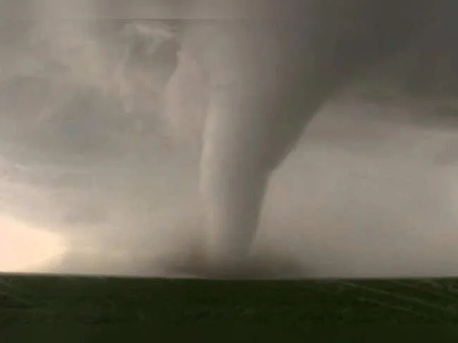
Tornado Warnings Issued for Parts of Ohio and Pennsylvania
Residents in portions of Ohio and Pennsylvania are urged to remain vigilant after the National Weather Service (NWS) issued multiple tornado warnings on Sunday, July 5, 2026. The warnings, which covered parts of Portage and Mahoning counties in Ohio as well as Perry County in Pennsylvania, came as severe thunderstorms capable of producing tornadoes moved through the region. The alerts are now expired, but the storms left many communities on edge and prompted a reminder about the importance of understanding severe weather warnings.
In Ohio, a tornado warning was issued for portions of Portage and Mahoning counties at 1:20 p.m. Sunday, remaining in effect until 2 p.m. The NWS reported that radar indicated possible rotation patterns in a severe thunderstorm located about 11 miles southeast of Ravena and 8 miles southwest of Newton Falls—a community that experienced a devastating F-5 tornado in 1985. The storm was expected to move mainly over rural areas, but officials warned that flying debris could pose a danger to anyone caught without shelter, and that mobile homes, roofs, windows, vehicles, and trees could suffer damage.
Meanwhile, in Pennsylvania, a tornado warning was issued for parts of Perry County on Sunday evening, affecting more than 14,000 people in Newport, New Bloomfield, and Landisburg. The NWS in State College reported that at 6:20 p.m., a severe thunderstorm capable of producing a tornado was located over Loysville, moving northeast at 20 mph. It was expected to reach New Bloomfield around 6:30 p.m. The warning expired by 6:45 p.m., but forecasters continued to track the storm system.
Understanding the Difference: Watch vs. Warning
With severe weather in the news, meteorologists emphasize that knowing the difference between a tornado watch and a tornado warning can save lives. A tornado watch is issued by the Storm Prediction Center and often covers a large area—sometimes multiple counties or states. It means conditions are favorable for tornado formation, but no tornado has been spotted. During a watch, residents should review emergency plans, check supplies, and identify safe shelter. A tornado warning, by contrast, is issued by your local forecast office for a much smaller area, typically the size of a city or small county. It means a tornado has been spotted or detected by radar, and immediate action is required to protect life and property.
The Stakes: Why These Warnings Matter
The stakes are high when tornado warnings are issued. In Ohio, the warning area included Newton Falls, a community that still bears the scars of the 1985 F-5 tornado that killed 18 people. That event remains one of the most destructive tornadoes in Ohio history. The current storm system, while not expected to reach that intensity, still posed a threat to life and property, particularly for those in mobile homes or vehicles. The NWS reminded the public that flying debris is the greatest danger during a tornado, and that the safest place is an interior room on the lowest floor of a sturdy building, away from windows.
In Pennsylvania, the Perry County warning covered over 14,000 residents. The NWS advised that if a tornado warning is issued, people should move swiftly to a safe location, whether at home, work, or school. For those without basements, officials recommend identifying a nearby safe building, such as a church or relative’s house, that can be reached quickly.
A Broader Pattern of Severe Weather
These warnings are part of a larger pattern of severe weather affecting the central and eastern United States. A related flood watch was issued for 10 counties in Ohio, including Greater Cleveland, until 10 p.m. Sunday, as heavy rains accompanied the storms. On Friday, July 3, a severe thunderstorm watch was already in effect for parts of Central New York, and more than 6,000 customers lost power in Oneida, Herkimer, and Hamilton counties. The frequency of such alerts highlights the need for year-round preparedness, especially during the summer months when warm, humid air masses collide with cold fronts to create volatile weather conditions.
Perspective: Broader Implications and Preparedness
The recent tornado warnings underscore a broader truth: severe weather can strike quickly and with little notice. As climate patterns shift, some regions may experience more frequent or intense storms. For residents in tornado-prone areas, the key takeaway is the importance of staying informed and having a plan in place. The NWS encourages all households to create a family emergency plan that includes a designated meeting place and important contact information. Sign up for community alerts, which may include outdoor sirens, media broadcasts, or smartphone notifications. Keep a NOAA Weather Radio or a reliable weather app on hand for real-time updates.
For sports fans, the weather disruptions are a reminder that even planned events can be impacted. While the storms caused no major disruptions to major sporting events this weekend, fans traveling to venues should always check forecasts. In other news, Summer McIntosh Chases Elusive 200 Fly World Record at Canadian Trials, showing that athletes and events must also contend with weather uncertainties.
Authorities also stress that after a storm passes, it is important to check on neighbors, especially the elderly or those with mobility issues. If you encounter downed power lines, stay away and report them to local utilities. Damage should be documented safely for insurance claims, and photos can be shared with local news stations to help track storm impacts.
How to Prepare for the Next Warning
To stay safe, follow these essential tips from the National Weather Service:
- Stay weather-ready: Monitor forecasts and tune in to local news or NOAA Weather Radio for updates.
- Sign up for alerts: Understand your community’s warning systems—sirens, media, or smartphone alerts.
- Create a communication plan: Designate a meeting place and share contact information with family members.
- Know your safe zones: At home, move to an interior room on the lowest floor. If in a mobile home or vehicle, find the nearest substantial shelter.
While the immediate threat has passed for Ohio and Pennsylvania, the severe weather season is far from over. As incidents like the 16 Children Rescued From Ohio Horror House Were ‘Almost Feral,’ Sheriff Says remind us, preparedness and community response save lives. Take the time now to review your emergency plans—because the next warning could come at any moment.
Comments