NOAA Forecasts Quieter Atlantic Hurricane Season as Super El Niño Develops
The National Oceanic and Atmospheric Administration released its 2026 Atlantic hurricane season outlook on Thursday, predicting a below-normal season driven by a rapidly intensifying El Niño pattern. The forecast calls for 8 to 14 named storms, 3 to 6 hurricanes, and 1 to 3 major hurricanes of Category 3 or stronger — well below the 1991–2020 average of 14 named storms, 7 hurricanes, and 3 major hurricanes.
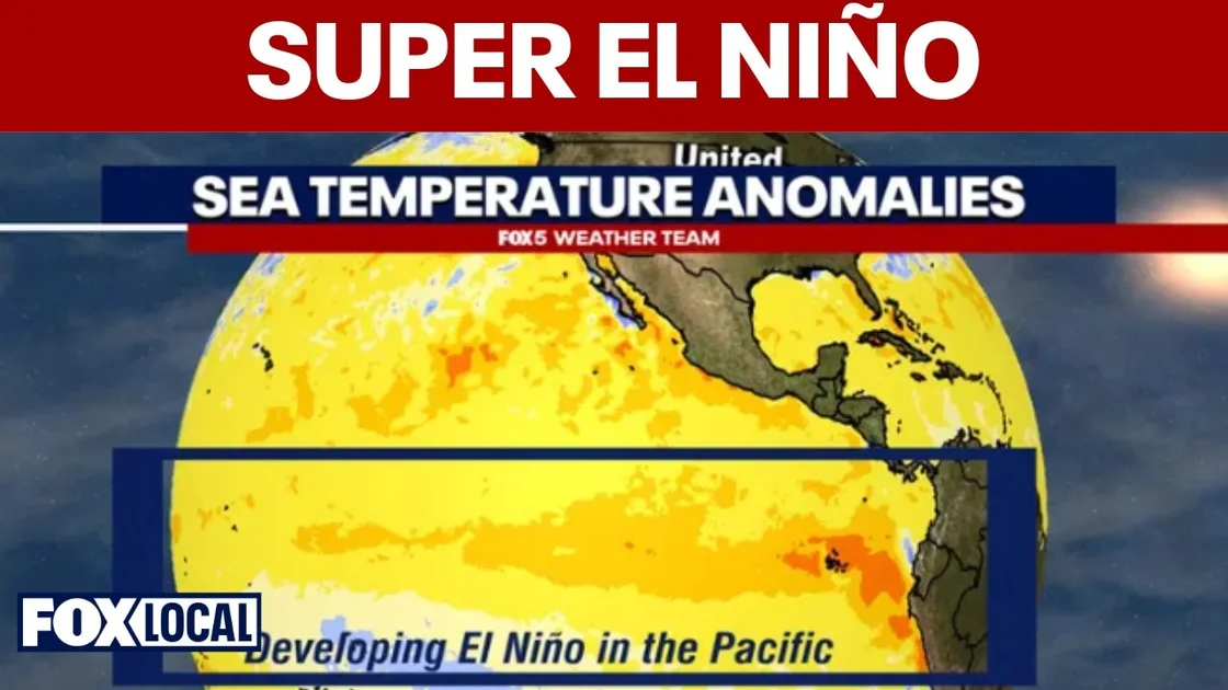
“When we look at the atmosphere and ocean conditions coming into this season, we see factors that will likely suppress hurricane development,” said Matthew Rosencrans, NOAA’s lead hurricane seasonal forecaster. The primary factor is El Niño, a warming of Pacific Ocean waters that generates strong upper-level winds across the Atlantic basin. These winds create wind shear that tears apart developing tropical storms before they can strengthen into hurricanes.
The Climate Prediction Center now places a 61% chance that El Niño will be in place by late summer, peaking during the most active hurricane months of August through October. The outlook aligns with earlier projections from Colorado State University, which forecast 13 named storms, 6 hurricanes, and just 2 major hurricanes.
Despite the quieter forecast, NOAA warned coastal residents not to let their guard down. “A below-normal season doesn’t mean a safe season,” Rosencrans emphasized, noting that even one powerful hurricane can devastate a community. The 2025 season produced 13 named storms and 5 hurricanes, including Category 5 Hurricane Melissa, which ravaged Jamaica.
Pacific Hurricane Season Supercharged by El Niño
While the Atlantic may experience a repressive effect, the eastern Pacific hurricane season — which runs from May 15 to November 30 — is expected to be supercharged. NOAA forecasts 15 to 22 named storms in the northeast Pacific, including 9 to 14 hurricanes and 5 to 9 major hurricanes, well above the normal average of 15 named storms, 8 hurricanes, and 4 major hurricanes.
“Above-normal precipitation probabilities are forecast for Southern California due to the likelihood of an active east Pacific hurricane season,” NOAA’s Climate Prediction Center noted. Most eastern Pacific hurricanes move westward away from land, but occasional storms bring moisture or lightning to California. In August 2023, former Tropical Storm Hilary brought heavy flooding to Palm Desert amid an El Niño year.
The probability of a landfalling hurricane in California remains low, but even glancing blows from decaying storms can trigger lightning sieges, massive waves, and unseasonal downpours. El Niño reduces wind shear in the eastern Pacific, a key ingredient for hurricane formation, while sea-surface temperatures off the west coast of Mexico are already favorable for development.
Could El Niño Break Texas’s Longstanding Drought?
For Texas, the arrival of El Niño carries a different kind of hope. The phenomenon generally brings cooler, wetter weather to the southern United States during fall and winter, potentially breaking parts of the state out of a protracted drought.
“Every El Niño manifests itself a little bit differently, but when we look on average at all of the El Niño events we’ve seen, we usually see a cooler and wetter winter across Texas,” said Joel Lisonbee, southern plains regional drought information coordinator for NOAA. The wetter conditions typically begin in mid-to-late fall and continue into early spring, bringing a mix of rain and snow. Lisonbee emphasized that the pattern is not guaranteed, but the 2026 event could be particularly intense.
Texas has been grappling with severe drought conditions across large swaths of the state, straining agriculture, water supplies, and wildfire preparedness. A wet winter could replenish reservoirs and soil moisture, though forecasters caution that one season of above-normal precipitation may not be enough to fully erase multiyear deficits.
Broader Implications and What This Changes
The contrasting outlooks — a quiet Atlantic but a busy Pacific — highlight the dual nature of El Niño’s influence on global weather patterns. For the Atlantic, the wind shear created by El Niño acts as a natural barrier to hurricane development, potentially sparing the U.S. East Coast and Gulf states from major landfalls. Yet the 2025 season’s devastation in Jamaica serves as a reminder that below-normal seasons can still produce catastrophic storms.
For the Pacific, the enhanced hurricane activity poses risks to Mexico’s coastline and, indirectly, to California’s already volatile wildfire and flood risks. Emergency managers across the Southwest are monitoring the forecast with heightened attention.
In Texas, the prospect of drought relief is the most immediate concern for residents and farmers alike. While El Niño offers no guarantees, the odds favor a wetter winter, which could provide a critical buffer heading into 2027.
NOAA will update its hurricane forecasts in August once the season is underway and forecasters have more data. The Atlantic hurricane season officially begins June 1, while the eastern Pacific season started May 15. For now, the message from forecasters is clear: prepare for the season ahead, regardless of what the averages predict.
Stay informed on extreme weather and other major events. For a break from the forecast, check out the Full 2026 World Cup Schedule Finalized as 48 Teams Prepare for Kickoff or read about Bill Ackman Dumps Alphabet, Piles $2.1B Into Microsoft in Major Tech Rotation.
Comments