
Nor'easter Triggers Rare Evacuation Order for Hatteras Island Visitors
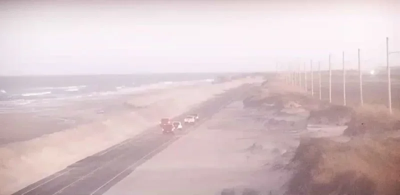
A developing nor'easter off the Carolina coast has forced Dare County to issue a mandatory evacuation order for all visitors on Hatteras Island, marking what appears to be the first time the county has taken such action ahead of a nor'easter rather than a hurricane. The order, effective at 8 p.m. Friday, October 16, applies to all seven Hatteras Island villages—Rodanthe, Waves, Salvo, Avon, Buxton, Frisco, and Hatteras—as the storm threatens prolonged coastal flooding, ocean overwash, and potentially extended closures of N.C. Highway 12.
The National Weather Service Newport/Morehead City office has forecast significant coastal impacts beginning Saturday, October 17, and continuing into early next week. The system, currently a coastal low off the Southeast, is expected to bring gusty winds, high surf, and coastal flooding to millions from the Jersey Shore to the Outer Banks. The National Hurricane Center has highlighted the system for possible subtropical or tropical development over the next seven days as it stalls off the Southeast coast, though forecasters caution the odds of that occurring remain low.
Hyde County Warns of Stranded Visitors on Ocracoke Island
Hyde County has issued a stark warning that the incoming nor'easter could strand people on Ocracoke Island if they do not leave by Saturday afternoon. Officials described Saturday morning as potentially the last chance to leave safely, urging people not to visit the island starting Saturday. The long-duration storm is expected to persist through early to mid-next week, bringing strong winds, rough seas, and coastal flooding to the Outer Banks. N.C. Highway 12 could be overwhelmed by ocean overwash, and drivers are advised not to attempt flooded roads. Severe winds over 30-35 mph will suspend sound ferry operations, and air-lift operations are predicted to be grounded during the storm's peak. Those who might need emergency services should not be on the island during the storm, the county said.
Context: A Lumbering Storm with Long-Lasting Impacts
According to weather.com, the October nor'easter is forecast to develop by the end of the weekend and linger into the upcoming week, bringing high surf, rip currents, coastal flooding, winds, and rain to parts of the East Coast for several days. While the system is not expected to be as strong as the late September nor'easter that eroded beaches and caused significant damage, its slow movement could mean impacts last longer than typical. The area most likely to be affected the longest appears to be from the Delmarva Peninsula to eastern North Carolina, with models pointing primarily to eastern North Carolina. Impacts include periods of rain, especially across the Outer Banks, pockets of flooding, gusty winds to 45 mph, and significant beach erosion and coastal flooding. High surf and rip currents are likely much of the week from Florida's Atlantic beaches to New England.
Forecasters remain uncertain about the amount of rain and wind farther up the coast, though models suggest the heaviest rain will remain focused around the Carolinas. There is a decreasing but nonzero chance that rain will reach as far north as coastal New England, while the chance for wind remains more possible. The duration of the storm is also still coming into focus, with some models weakening the low faster and turning its impacts into more of a nuisance by the end of the week.
A Region Still Recovering from September's Nor'easter
The brewing storm comes as many beaches along the East Coast are still dealing with significant erosion and other impacts from last month's early-season nor'easter. FOX Weather reports that the September storm slammed New Jersey with intense winds and rough surf, leaving coastal communities vulnerable. The new system threatens to compound those problems, particularly along the Outer Banks, where N.C. Highway 12 is a critical lifeline for residents and visitors.
The National Oceanic and Atmospheric Administration's winter forecast, released earlier this week, calls for increased chances of stormy weather along much of the East Coast due to a rapidly strengthening El Niño climate pattern. "Coastal storms like this are expected in an El Niño year," FOX Weather Hurricane Specialist Bryan Norcross said. "This El Niño is stronger than any in our experience, so this storm and the infamous nor'easter might well be harbingers of things to come this winter."
Perspective: A Signal of a Stormier Season Ahead
The mandatory evacuation of Hatteras Island visitors ahead of a nor'easter is a notable departure from historical practice, underscoring the severity of the threat and the vulnerability of the Outer Banks. While nor'easters are common along the East Coast, the decision to order visitors off the island reflects lessons learned from past storms and a recognition that even without hurricane status, these systems can be life-threatening and disruptive.
As the climate pattern strengthens, coastal communities from North Carolina to New England may face a more active storm season. The current system, regardless of whether it acquires subtropical characteristics, serves as a reminder that nor'easters can bring dangerous conditions over extended periods. Residents and visitors are urged to monitor forecasts, obey evacuation orders, and heed warnings of rip current danger. "If in doubt, stay out of the surf zone if breaking waves look impressive," weather.com advises. With the storm's exact track and intensity still uncertain, officials emphasize that preparation and vigilance are key.
Comments