Violent Tornadoes Tear Through Mississippi, Triggering Tornado Emergency and Trapping Residents
A dangerous severe weather outbreak swept across Mississippi on Wednesday night, May 7, 2026, as a confirmed large and violent tornado prompted a rare Tornado Emergency for several communities, including Bude, Meadville, McCall Creek, Brookhaven, and Bogue Chitto. The National Weather Service (NWS) in Jackson issued the urgent alert shortly after 7 p.m. CDT, warning residents of a “particularly dangerous situation” with catastrophic damage potential.
According to reports, the tornado was first observed near Meadville around 7:09 p.m., moving east at 50 mph. By 7:59 p.m., another confirmed large tornado was tracked near Enterprise, close to Brookhaven, moving at 35 mph. Governor Tate Reeves confirmed multiple tornadoes had been reported across central and western Mississippi, urging residents to monitor emergency alerts and stay sheltered.
“A large and extremely dangerous tornado is on the ground in Lawrence, Jefferson Davis, Lincoln County until 9:00 PM. TAKE COVER NOW!” warned meteorologist Patrick Bigbie of WDAM. First responders reported residents trapped inside damaged homes, though the full extent of injuries and damage remained unclear as dangerous conditions hampered rescue efforts.
More than 20,000 customers were without power across Mississippi by 9:30 p.m. EST, according to Fox Weather. The severe storm system also produced large hail, with reports of hailstones up to 2.75 inches in diameter in parts of Mississippi and Alabama.
Stakes Are High: Life-Threatening Conditions and Catastrophic Damage
The Tornado Emergency, reserved for the most dangerous tornado situations involving severe threat to life, was not a routine warning. The NWS emphasized that flying debris could be deadly, mobile homes could be destroyed, and complete destruction of well-built structures was possible.
Franklin County emergency officials reported that a major tornado tore through the Garden City area, destroying multiple homes and leaving some residents trapped. Authorities urged people to move to a basement or interior room on the lowest floor of a sturdy building, away from windows. Those in mobile homes, vehicles, or outdoors were told to seek substantial shelter immediately.
The storm’s path threatened several communities in succession: East Lincoln around 8:10 p.m., Sontag at 8:15 p.m., Monticello and Wanilla at 8:20 p.m., Silver Creek at 8:30 p.m., Oma at 8:35 p.m., and New Hebron at 8:40 p.m. The warning remained in effect until 9 p.m. CDT for parts of Lincoln, Lawrence, and Jefferson Davis counties.
Particularly Dangerous Situation (PDS) Warning
The NWS first issued a Particularly Dangerous Situation (PDS) tornado warning for north central Amite County at 7:19 p.m. CDT, later escalating it to a Tornado Emergency. This PDS designation signals an unusually intense and life-threatening tornado, with a high likelihood of significant damage and casualties.
Residents in the affected areas were told to expect catastrophic damage, including destroyed homes, businesses, vehicles, and deadly flying debris. The tornado was also capable of hail up to 1.25 inches in diameter.
Power Outages and Travel Hazards
As the storms battered the state, more than 20,000 customers lost power, according to Fox Weather. Emergency crews warned that dangerous conditions slowed response efforts, with sheriff’s deputies sheltering in some areas due to ongoing storm threats and hazardous road conditions. Drivers were advised to avoid interstates, particularly I-55 near Brookhaven, where the tornado was expected to pass.
The severe weather outbreak also triggered flash flood warnings in parts of Louisiana and Alabama, including in major cities like Alexandria, Louisiana, and Montgomery, Alabama.
Broader Implications: A Rare Spring Tornado Outbreak After Record-Quiet April
This tornado outbreak marks a dramatic end to a rare two-month spring stretch without tornadoes in parts of the Southeast. The quiet April gave way to an active May, with a massive cold front unleashing severe storms across more than 25 states.
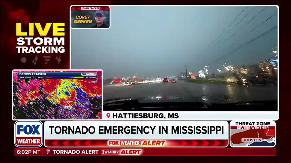
Meteorologists noted that two tornadoes were active simultaneously in Mississippi on Wednesday evening, including storms near Hattiesburg and Bude. Earlier in the evening, a tornado was confirmed between Lexie and Simmon, Mississippi. The synoptic pattern driving this outbreak is consistent with a volatile spring transition, where strong jet stream dynamics clash with moist, unstable air from the Gulf of Mexico.
Comparing Today’s Threat to Past Mississippi Tornadoes
Mississippi has a grim history with powerful tornadoes. The 2011 Super Outbreak devastated parts of the state, and the 2023 Rolling Fork tornado remains a recent scar. While today’s storms have not yet reached that scale, the PDS warning and Tornado Emergency indicate that this system is exceptionally dangerous. The debris signature observed on radar—debris lofted up to 12,000 feet—is a hallmark of a violent tornado.
Governor Reeves activated the Mississippi Emergency Management Agency (MEMA) to coordinate search and rescue efforts. “The State of Mississippi is in contact with local emergency managers and first responders. @MSEMA is currently coordinating State SAR,” he posted on social media.
Economic and Infrastructure Impact
Beyond immediate life safety, the tornado outbreak carries significant economic consequences. Widespread power outages disrupt businesses, schools, and healthcare facilities. Damage to homes and infrastructure may take weeks to assess, with reconstruction likely costing millions. The area affected includes agricultural zones and small towns where recovery could be slower due to limited resources.
For readers looking for a lighter topic, this week also marks the countdown to Mother’s Day 2026, with many families planning celebrations — but for those in the storm’s path, safety remains the priority.
What This Changes: Tornado Preparedness and the Role of Technology
This event underscores the critical importance of tornado preparedness, particularly in the Southeast, where the traditional “Tornado Alley” has shifted eastward in recent years. The timing of this outbreak—after a quiet spell—may lull some into complacency, but the ferocity of Wednesday’s storms serves as a stark reminder.
The Value of Real-Time Warning Systems
Modern radar technology and meteorologists on the ground provided crucial lead time. The NWS’s ability to detect a debris signature and issue precise, location-specific warnings likely saved lives. Yet, the fact that residents still ended up trapped in damaged homes highlights the limits of warnings without robust shelter infrastructure.
Public response to warnings remains a challenge. Many residents do not have access to basements, especially in the Gulf states, where high water tables make underground shelters impractical. Community storm shelters and safe rooms are essential, but they are not universally available.
Broader Trends: Climate and Severe Weather
While no single storm can be directly attributed to climate change, scientists have documented an increase in the frequency and intensity of severe thunderstorms in the eastern United States. Warming temperatures and increased atmospheric moisture provide more fuel for supercell storms capable of producing violent tornadoes.
This outbreak may also prompt renewed discussions about building codes and disaster funding in vulnerable regions. The damage in Franklin County alone, with multiple homes destroyed, adds pressure on state and federal resources.
Meanwhile, other national headlines continue to develop. In the tech world, the ongoing legal battle between Elon Musk and OpenAI saw dramatic testimony this week as a key witness testified he feared a physical attack. And for sports fans, the Myrtle Beach Classic teed off amid a $15.8M economic boom for the region.
Conclusion: Continued Vigilance Required
As the storm moves eastward, residents in eastern Mississippi and western Alabama remain under Tornado Watch until 11 p.m. CDT. Over 2.4 million people across Louisiana, Mississippi, and Texas are under threat of tornadoes EF-2+ in strength, large hail, and damaging winds.
The immediate priority is search and rescue for those trapped and ensuring public safety. The longer-term challenge will be recovery and rebuilding, and ensuring that the lessons from this outbreak strengthen community resilience against the next one.
For now, officials urge everyone in the affected region to continue monitoring emergency alerts and stay sheltered until the threat passes.
Comments