
Hurricane Marie Brings High Surf and Flooding to Southern California
Hurricane Marie continues to churn hundreds of miles off the Pacific coast, but its distant power is making itself felt across Southern California this Labor Day weekend. While forecasters had all but ruled out a direct landfall, the Category 2 storm has generated massive swells, triggered coastal flooding, and injected tropical moisture into the region's atmosphere.
As of Saturday, the National Weather Service (NWS) reported that Marie's impacts—dangerous surf, strong rip currents, and scattered rain—were underway and expected to persist through Tuesday night. Coastal communities from Ventura County down to Orange County have been on alert, with advisories for high surf and coastal flooding in effect through 11 p.m. Tuesday.
In Seal Beach and Long Beach, water from powerful waves overran sand berms that crews had hastily constructed earlier in the week. Aerial footage showed an SUV stuck in a flooded parking lot before bystanders helped push it free. Pumping operations were underway to clear water from parking lots and some homes, while bulldozers worked to rebuild the eroded barriers before even stronger surf arrived on Sunday.
Why the Storm’s Distance Doesn’t Mean Safety
Marie formed in the eastern Pacific Ocean off Mexico early Tuesday and quickly intensified. Models initially sparked concern among some meteorologists—and residents planning holiday outings—when a few outlier projections suggested the hurricane could turn northward toward Southern California. Those scenarios never materialized, however.
UC climate scientist Daniel Swain wrote in a blog post that the odds of an actual hurricane landfall were "essentially zero." The core of the storm will pass about 800 miles southwest of Los Angeles, sparing the region from hurricane-force winds. But the storm’s sheer size means its energy still reaches the coast in the form of a 6- to 8-foot south swell.
That swell, combined with evening high tides, has raised the risk of moderate flooding in low-lying spots such as Avalon, Long Beach’s Alamitos Peninsula, Malibu, and Point Mugu. The NWS described the surf and rip currents as "dangerous and potentially life-threatening."
"The best course of action is to stay out of the water," said NWS meteorologist Devin Black. "It’s the safest thing to do."
The dangerous ocean conditions come after a deadly summer along Southern California beaches, where several swimmers and a child drowned. Officials renewed warnings for beachgoers to swim near lifeguards and to be aware of rip currents, which can pull even strong swimmers out to sea.
Rain and Muggy Weather Complicate Holiday Plans
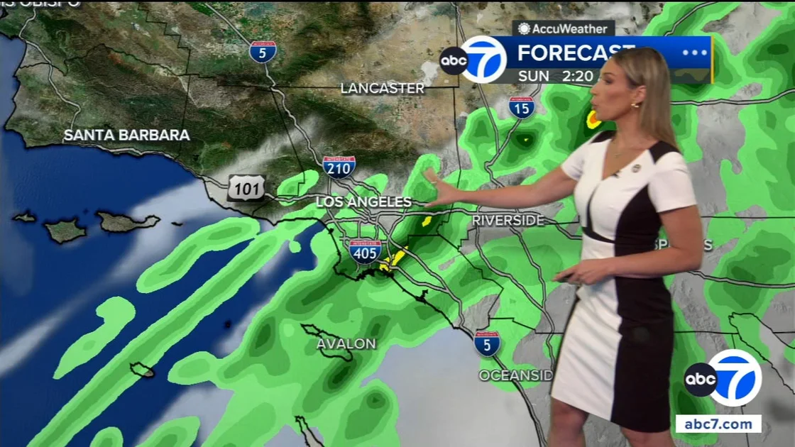
In addition to the surf threat, Marie is also drawing tropical moisture northward, leading to an unusual forecast for early September: rain. The NWS predicts the wettest period will be Sunday, with widespread but light rainfall—generally less than a quarter inch. Higher elevations, particularly in the San Gabriel Mountains, could see up to three-quarters of an inch. There is also a 5% to 15% chance of thunderstorms, mainly on Sunday.
"Everyone is worried, 'Is that going to affect our plans this weekend'?" said CBS LA Weather Anchor Chloe Carlson. "Well, for some of you, you may have to find a different time to barbecue."
Forecasters also warned that roads may be "quite slick" despite the light rain, due to the buildup of oils from months of dry weather. Humidity levels will be noticeably higher, bringing muggy conditions—a sharp contrast to the typical dry heat of the holiday weekend.
Temperatures are expected to be slightly below normal, with inland areas topping out in the high 80s. But the weather service advises anyone heading to the coast to reconsider. Beaches are likely to see rough conditions, with waves breaking over berms and jetties, and the danger from rip currents remains high.
Broader Implications: Reminders of a Changing Coastal Landscape
Hurricane Marie’s effects—even without a direct hit—serve as a reminder of how vulnerable Southern California’s coastline is to distant storms and rising sea levels. The storm’s surges have already eroded beaches and damaged infrastructure, notably at Aliso Beach in Laguna Beach, where recent surges caused damage to a parking lot and forced construction of sand berms.
Climate scientists have noted that while the region rarely experiences direct hurricane landfalls, the combination of stronger Pacific storms and sea level rise increases the impact of every distant swell. A storm passing 800 miles away can still cause flooding, erosion, and dangerous surf—as seen this weekend.
For now, emergency officials are focused on the immediate hazards. In addition to coastal flooding, the NWS has issued advisories for Santa Catalina and Santa Barbara islands, Malibu, Los Angeles, and Ventura County. Surf is expected to peak Sunday and remain hazardous through Tuesday night.
Beyond the local challenges, the storm also underscores the need for communities to adapt to more frequent high-surf events and coastal flooding. As the Labor Day weekend continues, officials urge people to avoid the water, stay off jetties, and heed local warnings—even if the sun breaks through the clouds.
Meanwhile, those looking for other weather news may note that this year has already seen Hurricane Lowell Intensify to Category 4, Threatening Hawaii with High Surf and Wind, another sign of an active Pacific hurricane season.
Comments