
Hurricane Genevieve Intensifies to Category 4, First Major Storm of 2026
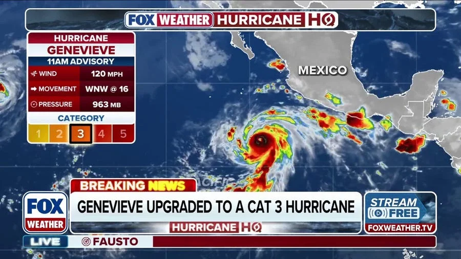
Hurricane Genevieve has rapidly intensified into a Category 4 storm, becoming the first major hurricane of both the Eastern Pacific and Atlantic hurricane seasons, according to the National Hurricane Center (NHC). As of Sunday afternoon, the storm’s sustained winds reached 140 mph, with its center located approximately 530 miles southwest of Manzanillo, Mexico.
The storm — the seventh named system in the Eastern Pacific in 2026 — is moving west-northwest at 14 mph. Forecasters expect further strengthening in the short term before a gradual weakening trend begins later this week. While Genevieve remains a powerful system, it is not forecast to make landfall, and heavy rainfall is expected to stay offshore.
Rapid Intensification and Major Hurricane Status
Genevieve crossed the major hurricane threshold early Sunday when it reached Category 3 strength with winds of 120 mph before escalating to Category 4 by midday. A major hurricane is defined as Category 3, 4, or 5 on the Saffir-Simpson Hurricane Wind Scale, capable of causing devastating damage should it approach populated areas. Satellite imagery shows a symmetrical eye, indicating that the storm remains well organized and is encountering little to weaken it.
Hurricane Fausto Weakens on Approach to Hawaii
While Genevieve dominates headlines in the open Pacific, another storm — Hurricane Fausto — is tracking westward toward the Hawaiian Islands after peaking as a Category 2 storm. Fausto has since weakened due to cooler waters and strengthening wind shear, and is expected to degrade to a tropical storm by late Monday or early Tuesday.
Forecasts show Fausto passing north of the Hawaiian Islands on Tuesday into Wednesday. The primary threats are not direct wind damage but high surf and swells building along east-facing shores from Sunday through Tuesday. The FOX Forecast Center noted that surrounding dry air should limit widespread flooding, though localized heavy downpours remain possible. The storm is expected to be a weakened tropical system by the time it makes its closest approach to Oahu and Kauai.
Broader Context: A Quiet Atlantic, Active Pacific
The 2026 hurricane season has so far seen notable activity in the Eastern Pacific, while the Atlantic basin remains quiet after Tropical Storm Bertha faded. Genevieve’s rapid intensification underscores a trend of storms strengthening quickly over warm ocean waters — a pattern scientists link to rising sea surface temperatures. Meanwhile, Hawaii is closely monitoring Fausto, a reminder of the risks posed by Pacific storms even when they arrive weakened.
Genevieve’s path well offshore of Mexico spares coastal communities from the worst effects, but the storm’s early arrival as a major hurricane raises questions about the remainder of the season. Both the Eastern Pacific and Atlantic hurricane seasons run through November 30.
What This Means for the 2026 Season
The emergence of a major hurricane so early in the season aligns with forecasts for an above-average hurricane year. The record of rapid intensification events, such as Genevieve’s leap from Category 3 to 4, highlights the challenge of preparing for storms that can change strength quickly. While Genevieve may pose no direct threat to land, its presence serves as a reminder of the unpredictable nature of tropical weather and the importance of ongoing monitoring.
Forecast models indicate that Genevieve will gradually weaken later this week, but its impact on shipping lanes and remote sea routes will be monitored. For now, attention remains split between the two storms, with Fausto’s approach to Hawaii a secondary but closely watched event.
As the season progresses, the Pacific is expected to remain active. Meanwhile, the Atlantic’s quiet start may not last, as conditions often shift in late summer. The NHC continues to track both storms and provide regular updates.
Comments